
myWorld App Release 2.1
Explore myWorld App’s newest customer-driven features in release, 2.1, featuring customizable maps and weather overlays.
Customize Maps with Multiple Overlays
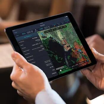
Choose from multiple base layers -- IFR enroute high, IFR enroute low, VFR low altitude, satellite, light, dark -- to view the information you want. You can overlay multiple layers over the base layer, including weather, alternate routes, and ETPs, for optimal clarity when you plan your trip. Other layers for customization include FIR, radar, SIGMETs, and more.
For example, you can choose the IFR enroute high or the IFR enroute low plus the lightning layer and the wind layer to ensure the safety of your flight. Instead of starting the map from scratch to view other layers, you can quickly add or remove layers with the new quick-access icons.
Our technology team is collaborating with the weather provider, WSI, ensuring the accuracy and timeliness of weather updates.
Quickly Search Alternative Airports While Creating a New Leg
Quickly finding alternative airports is now more accessible on the myWorld App with Airport Summary Cards. This information in the Airport Summary Cards allows you to quickly change airports as you adapt to weather or passenger changes. While creating a new leg, Airport Summary Cards detail information for specific airports, including current wind information, surface analysis of METAR and TAF, winds aloft, NOTAMs and FBOs. There is also quick access to airport and country card information that highlights NOTAMs, weather, and IAP (Airport/SID/STAR) information.
Access IAP (Airport/SID/STAR) Charts
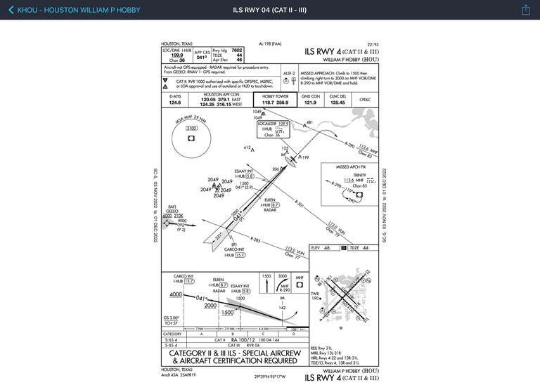
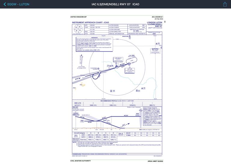
The new release has IAP Charts for 164 countries, and you can quickly share with others using the share functionality.
Access Services from the Leg Card
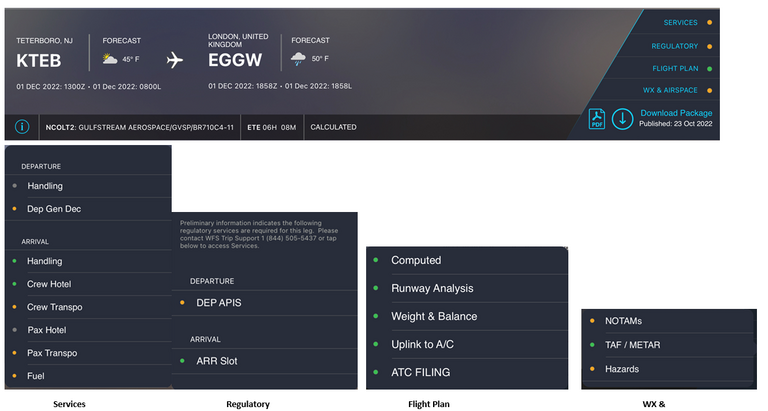
You can quickly navigate to sections within the leg to check the status of the following:
-
Services – such as Gen Decs, Customs, APIS, handling, crew/pax hotel, crew/pax transportation, fuel…etc
-
Regulatory – APIS, arrival/departure Slots, overflight/landing Permits ….etc
-
Flight plan
-
Computed – complex calculated and navigational log
-
Weight and balance
-
Runway analysis
-
Uplink to aircraft – via Satcom Direct, or Arinc Direct, or GDC
-
ATC filing
-
-
Weather information – such as NOTAMs, TAF/METAR, Hazards
Create Routes Without SID or STAR
Now you can generate routes with or without the Standard Instrument Departure (SID) or the Standard Instrument Arrival (STAR) when initially loading a leg from Create New Leg or within Route Options.
Archive Trips

Additionally, you can archive trip cards you no longer wish to see on the dashboard. This functionality will reduce clutter on the Dashboard helping you stay on course for what you have planned.
Simply tap the circle on the trip card and select "Archive Trip Cards" on the top right of the screen. Return to your trip by tapping on the file folder.
Collapse Fields in APG Weight and Balance
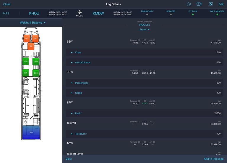
New features for APG and the Runway Analysis include collapsible and expandable sections, with the added ability to view the APG Release from Runway Analysis so you don't need to return to the Weights & Balance screen.
Generate an APG Release from Runway Analysis, Sign and Share the Release
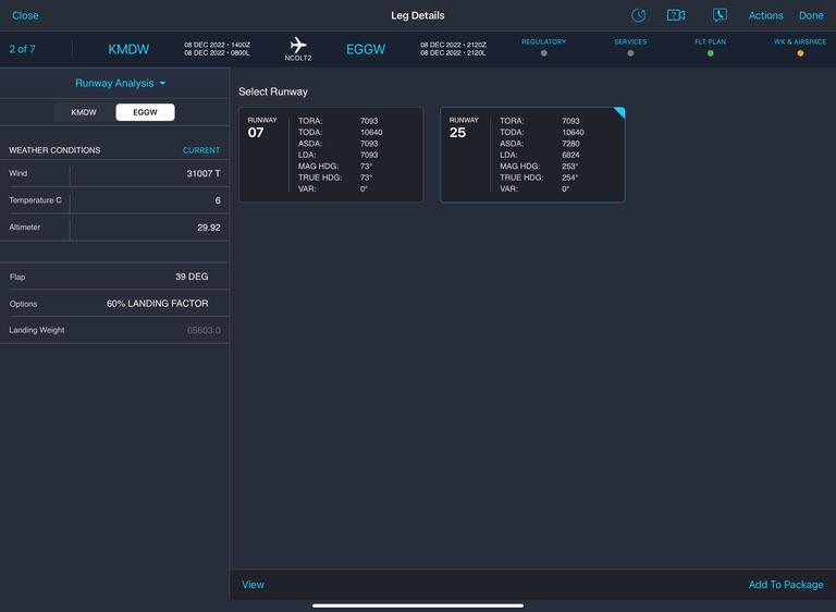
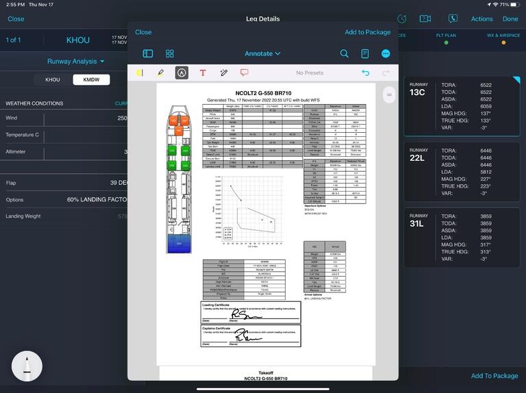
New feature allows users to not only view the APG release from the runway analysis, but also sign and share it.
Create a New Runway Analysis Offline
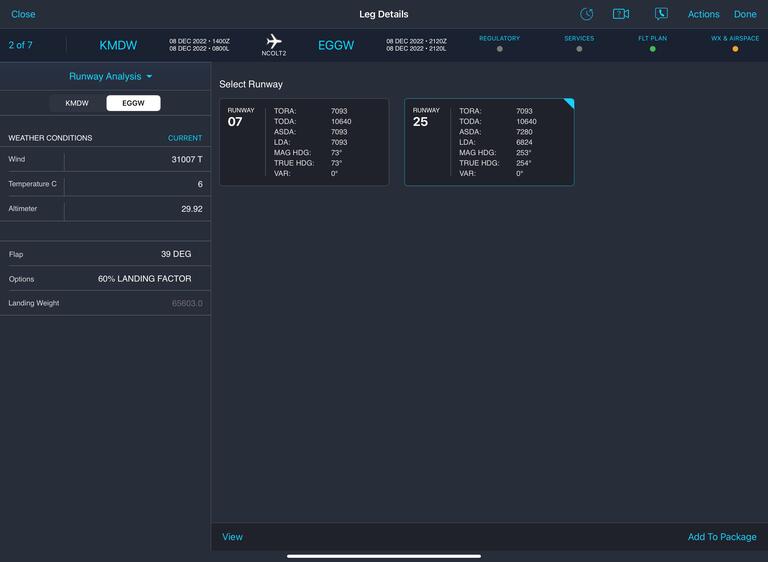
If runways change, you can regenerate a new release with an updated Runway Analysis in real-time and offline.
Search for ETP Airports Within ETOPs and ETPs
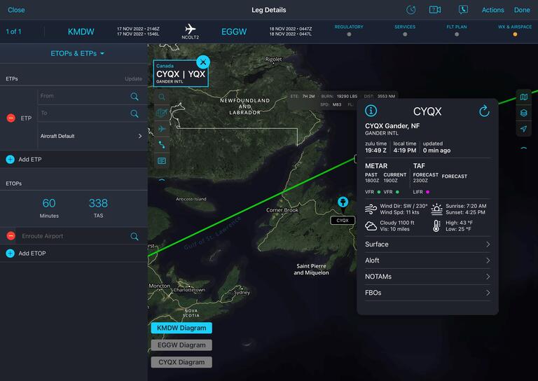
Within ETOPs and ETPs section of the app the ability to search for airports to locate usable Airports for the ETOPs and ETPs.
Download myWorld 2.1 on the App Store Now
Have questions about myWorld or need support?
We are here to help.
Local: +1 281 280 2221
Toll Free: +1 844 505 5437
Email Us

